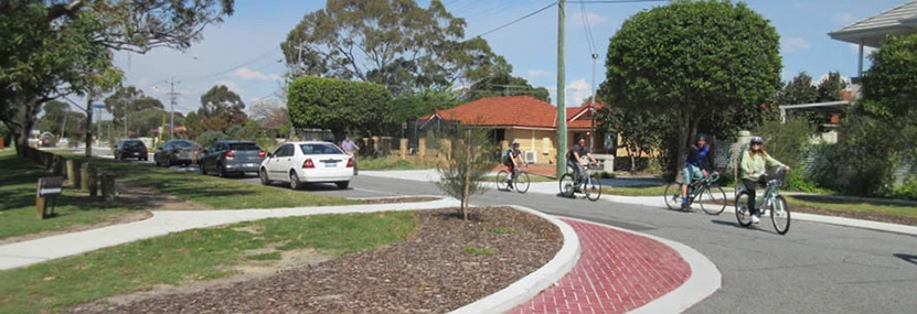
a group of people riding bicycles on a street
  • Open date

    9 March 2026

  • Last updated

    8 October 2026

The City of Stirling maintains over 1,000km of road and 900km of footpaths. We are committed to providing a well-connected, safe, and accessible network of roads for our residents and visitors. To achieve this, the City is continually assessing and reviewing the functionality of our road systems to identify areas for improvement.

Through targeted speed reductions, road safety infrastructure, and community consultation, we’re working across the City’s 30 suburbs to reduce crashes, calm traffic, and create safer neighbourhoods for our whole community.

Why road safety matters

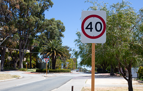
Slower speeds In areas with newly introduced 40km/h zones, average vehicle speeds typically drop by 5–10km/h. In the City of Perth, where these zones have steadily expanded since 2011, speeds have shifted from the mid-to-high 40s down to the low 40km/h. or even high 30km/h.

Pedestrian safety The risk and severity of road-related incidents drops dramatically at 40km/h compared to 50km/h. Drivers have more time to react to unexpected events, such as children running onto the road.

Traffic calming Lower speed limits naturally calm traffic, encourage safer driver behaviour and improve compliance with road rules.

Active transport Slower road environments make walking and cycling safer and more enjoyable, encouraging people to choose healthier, more active ways to get around.

Improved amenity Reduced noise and traffic speeds contribute to a more pleasant and liveable environment.

The City’s annual civil works program is developed to keep our traffic and transport network safe and efficient for all users. This is achieved through construction, maintenance and renewal within the road reserve and includes road modifications, upgrades and resurfacing.

Get involved

To lodge a submission about a Roads, Traffic or Civil Works program, please click the link below.

Open for consultation

Earlier this year, the City implemented changes to parking restrictions in Swainson Place, relocating the existing No Parking sign to improve visibility and sightlines at the cul-de-sac.

The changes were introduced as a six-month trial. Now that the trial period has concluded, the City is seeking feedback from local residents to help determine whether the current No Parking sign location should be made permanent.

Feedback received as part of this consultation will help inform the City's review and decision-making process. Residents who provide feedback will be kept informed of the outcome.

Phase: Open for consultation. Submissions close on 10 November 2026.

2025/26 Closed consultation projects

The consultation for the proposed parking restrictions on Deanmore Road has now closed.

Residents of Deanmore Road have raised concerns that parked vehicles are restricting access to the street and driveways during school drop-off and pick-up times.

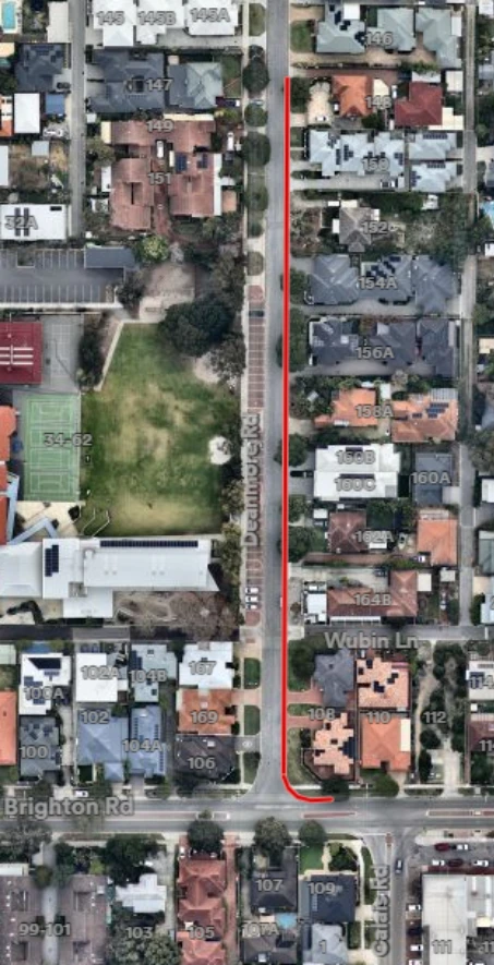
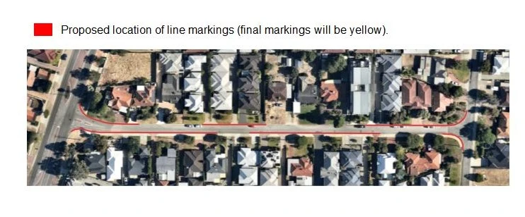
The City has received correspondence from several residents requesting the installation of a continuous yellow No Stopping line along part of the street (see the plan of the proposed location below).

Proposed location for No Stopping line marking. Final marking will be in yellow.  

Proposed restricted parking – Deanmore Road, Scarborough

A continuous yellow line prohibits stopping or parking along the marked section of road at all times—24 hours a day, seven days a week. The restriction would apply to all vehicles, including those belonging to residents, visitors and anyone visiting a property.

In these circumstances, the City usually installs timed No Stopping signs that apply from 7.30am to 9.30am and 2.30pm to 4.00pm on school days. This manages parking during peak school activity while retaining on-street parking at other times for residents, visitors and other road users.

In response to the request from local residents, the City sought feedback from all affected residents. The feedback received is being considered, residents who made a submission will be advised of the outcome.

Phase: Consultation closed (3 November 2026).

The consultation on the proposal to improve road safety around Inglewood Primary School has now closed. 

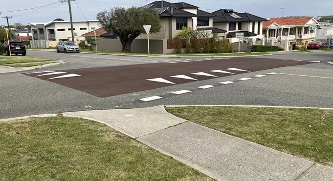
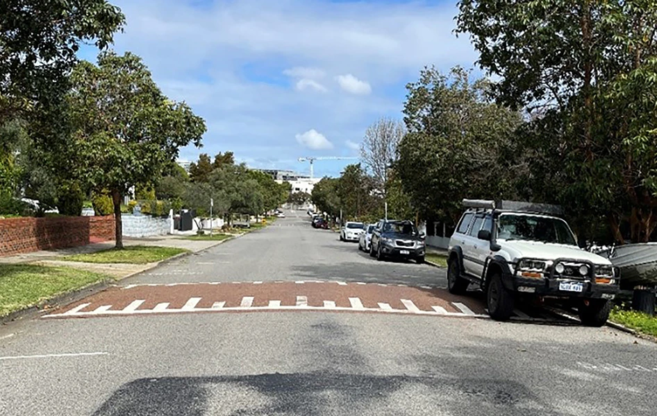
In response to community concerns, the City proposed installing traffic calming treatments at the four key intersections near the school. The proposal also included a raised zebra crossing on Robinson Street near Crawford Road and an additional midblock plateau on Normanby Road to support the traffic treatments near the intersections. The plan linked below shows the types and locations of the proposed treatments. 

These treatments aimed to reduce traffic speeds and support safer access for children, families, staff and the wider community, particularly during busy drop-off and pick-up times. 

The City sought feedback from the local community to understand the level of support for the proposal and any concerns about how the proposed treatments may affect people living, travelling or parking in the area. 

Following the consultation period, all feedback received is being reviewed and considered, and will help inform the final design and the City’s decision on whether to proceed with a funding application to Main Roads WA. 

Phase: Consultation closed (28 October 2026) 

View plan: Proposed treatment locations

The consultation on the proposal to restrict parking on Kyarra Street has now closed. 

Residents on Kyarra Street have raised concerns about parked vehicles restricting access along the roadway. As Kyarra Street is a local access road less than 6 metres wide, parking can only be legally accommodated on one side of the road at a time.

The City’s preference in cases such as this is for parking to be managed informally by the community, allowing individuals to park on either side of the road, provided they do not cause an obstruction by parking opposite an already parked vehicle.

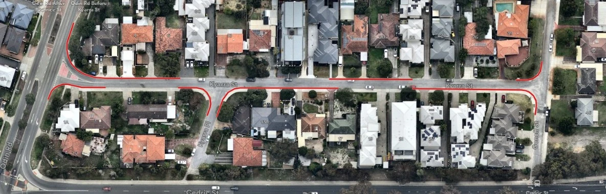
To address resident concerns, the City is considering the installation of staggered No Stopping line markings to discourage vehicles from parking opposite each other and to improve vehicle movement and enhance safety for all road users.

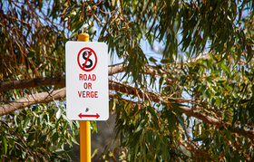
Please be aware that parking any part of a vehicle on a footpath or verge without permission from the property owner is illegal. The City’s Community Safety team may be contacted if you observe this occurring.

Responses received will help inform the decision-making process, and residents who provide feedback will be kept informed of the outcome.

Phase: Closed (16 October 2026)

Proposed restricted parking - Kyarra Street, Innaloo


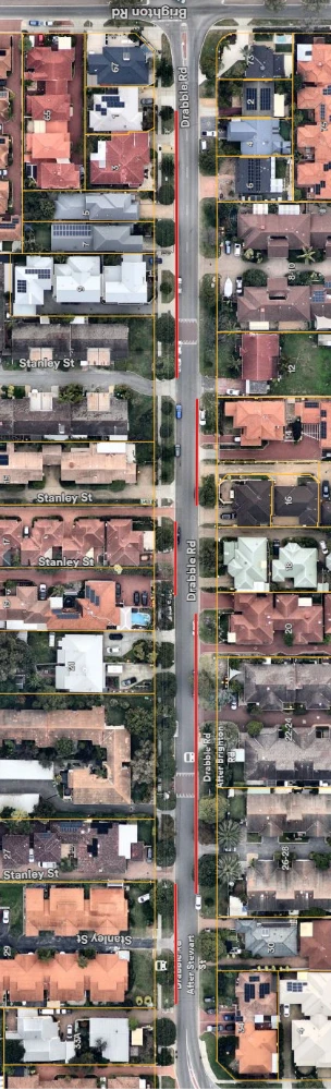
The consultation on the proposal to implement parking restrictions on Drabble Road has now closed. 

Please note that the parking restrictions would not apply to verges where the property owner has given permission to park.  

The proposal has been developed following concerns about road safety and access when vehicles are parked in this location. 

We are seeking feedback from local residents to understand the level of support for, or opposition to, the proposal.  

Feedback received during the consultation period will be reviewed and considered before the City determines whether to proceed with the proposal.  

If you would like to participate in this consultation in an alternative format or need support to complete a submission, please contact the City on 9205 8555.  

To keep up to date with projects in your local area, please visit your local suburb page www.stirling.wa.gov.au/suburbs

Phase: Closed (29 September 2026).


Proposed parking restriction – Drabble Road, Scarborough


Project update

The consultation on a proposal to permanently close the Tyler Street and Cape Street intersection in Tuart Hill is now closed.

After concerns were raised about pedestrian safety, the City consulted with residents in September 2025 on a proposed trial closure. A letter was sent to 570 residents, and 193 responses were received, with 81 per cent in support of the trial. 

Council endorsed a minimum three-month trial closure at its meeting on 25 November 2025.

The purpose of the trial was to assess the impact on the surrounding road network and to gauge community support for a permanent closure.

Community feedback will help inform the Council’s decision, and residents who lodge a submission will be kept updated on the outcome.

A report detailing the trial’s impact on local traffic, as well as the outcomes of the post-trial community consultation will be presented at the Community and Resource Committee Meeting to be held on 18 August 2026.

For further information, please refer to the Council Report Minutes linked below.

Phase: Closed 16 June 2026.

Council Report Minutes: 28 May 2024 12 August 2025 and 25 November 2025

The consultation on the proposal to install No Stopping (during school drop-off and pick-up times) signage on Alford Street has now closed. 

The consultation was conducted in response to resident concerns about access to the street and driveways during school drop-off and pick-up times due to parked vehicles. A letter was sent to 22 households, with eight responses in support and no objections to the proposal.

Survey respondents have been advised the signage will be installed.

Phase: Closed (Tuesday 19 May 2026).

The consultation on the proposal to implement staggered No Stopping line markings to Sykes Avenue has now closed.

Residents on Sykes Avenue have raised concerns about parked vehicles restricting access along the roadway. As Sykes Avenue is a local access road less than 7.2m wide, parking can only be legally accommodated on one side of the road at a time.

The City’s preference in cases such as this is for parking to be managed informally by the community, allowing individuals to park on either side of the road, provided they do not cause an obstruction by parking opposite an already parked vehicle.

To address resident concerns, the City is considering the installation of staggered No Stopping line markings on the street to discourage vehicles from parking opposite each other and to allow for easier enforcement by our Community Safety team. Please see below plan for proposed location of line markings.

Sykes-Avenue-Proposed-Location-of-Line-Marking

Residents are advised that parking any part of a vehicle on a footpath or on a verge, without permission of the property owner, is illegal. The City’s rangers may be contacted if you observe this occurring.

Responses received will help inform the decision-making process, and residents who provide feedback will be kept informed of the outcome.

Phase: Closed (Tuesday 21 April 2026).

The consultation on the proposal to implement No Stopping on the south side of Halley Street is now closed.

Residents on Halley Street raised concerns about parked vehicles restricting access along the roadway. As Halley Street is a local access road less than 7.2m wide, parking can only be legally accommodated on one side of the road at a time.

The City’s preference in cases such as this is for parking to be managed informally by the community, allowing individuals to park on either side of the road, provided they do not cause an obstruction by parking opposite an already parked vehicle.

To address resident concerns, the City is considering the installation of No Stopping line markings on the south side of the street to discourage vehicles from parking opposite each other and to allow for easier enforcement by our Community Safety team. The south side has been selected as it maintains the greatest number of on-street parking opportunities for residents.

Residents are advised that parking any part of a vehicle on a footpath or on a verge, without permission of the property owner, is illegal.  The City’s rangers may be contacted if you observe this occurring.

Responses received will help inform the decision-making process, and residents who provided feedback will be kept informed of the outcome in due course.

Phase: Closed (31 March 2026)

The City of Stirling is committed to improving road safety by enhancing the safety of the local road network. In response to resident concerns about speeding and driver behaviour along Karrinyup Road between West Coast Drive and Arnott Street, the City has explored several measures to resolve these issues.

Surveys conducted in 2023 recorded an average of 9,400 vehicles per weekday, with speeds slightly exceeding the 60km/h limit. Traditional traffic calming treatments such as speed humps, plateaus, and chicanes have been ruled out due to noise and safety concerns.

Proposed safety upgrade

The City is seeking feedback on the following proposed measures:

  • Resurfacing the eastbound kerbside lane in red asphalt to designate it as a parking only lane
  • Constructing raised parking nibs in the eastbound direction to prevent vehicles from entering the kerbside lane as a traffic lane. 

Local residents are advised that parking nibs will impact the manoeuvrability of rubbish collection trucks. The below plan shows the proposed treatment locations and bin placement for uninterrupted waste collection. On collection days, please avoid parking in front of bins.

Feedback on the proposed improvements will be presented to Council for consideration in the review of the 2025/2026 budget. Residents who respond will be kept informed of the outcomes.  

View map: Karrinyup Road, Trigg Plan

Phase: Consultation closed (Monday 1 December to Monday 22 December)

Project update

The consultation on the proposal to improve safety at the intersection of Summerhayes Drive and Clement Drive has now closed.

Traffic data review 
In response to community concerns, the City conducted a traffic data review. The review considered traffic volumes, vehicle speeds, crash history, road layout and nearby destinations such as shops, parks and schools.  The review found that, based on current criteria, the intersection is a low priority for traffic or speed management changes. 

Proposed safety upgrade
A report presented to Council on 1 July 2025 outlined two options for improvements at the intersection. 

  • A large roundabout was considered but not supported due to high costs. 
  • A minor redesign of the intersection, including consideration for a raised roundabout with a possible tree. However, adding a tree to the roundabout was not suitable due to limited space for vehicles and trucks to turn safely, risk of vehicle damage, and ongoing maintenance challenges. 

A report detailing the outcomes of the community consultation will be presented to Council for consideration. Locals who have provided feedback will be kept informed of outcomes, and progress updates will be shared on this page.

View plan: Intersection of Summerhayes Drive and Clement Drive, Karrinyup

Phase: Consultation closed (Monday 3 November to Tuesday 2 December)

Council minutes: Meeting of Council - 1 July 2025 and 24 February 2026

Project update

The consultation for the proposal to install five safety platforms and a zebra crossing on Davenport Street has now closed.

Traffic data review

A traffic data review in May 2024 revealed a significant increase in traffic volume in the area. Crash records from 2020 to 2025 show that 30 incidents have occurred on the streets surrounding the shopping centre, with 20 of these taking place on Davenport Street, 13 of these crashes involved vehicles exiting driveways. Recent community engagement also highlighted that road and traffic management is a top local priority for the suburb.   

Proposed safety upgrade

The design will enhance safety by preventing and reducing the severity of traffic related incidents. Site-specific constraints, including driveway locations, road layout, and utility services have been considered.  A plan of the proposal is included below. 

Your feedback on the proposed safety improvements on Davenport Street will be considered in the City’s submission for Black Spot funding to the Federal and State Governments. Locals who provided feedback will be kept informed of the outcomes, and progress updates will be shared on this project page. 

View plan: Davenport Street Plan

Phase: Consultation closed (Monday 3 November to Tuesday 2 December)

Council minutes: Meeting of Council - 27 May 2025

Project update

The consultation for the proposal to introduce a 40km/h zone to the local streets north of Karrinyup Road up to and excluding North Beach Road has now closed.

Why is the City proposing a 40km/h suburb speed zone?

This change aims to reduce driver speed and improve safety for pedestrians, bike riders and drivers. Low speed limits on local streets have been shown to reduce the number and severity of crashes, creating safer, more liveable neighbourhoods.

A report detailing community feedback will be presented to Council for consideration.

View map: Map of proposed speed zone

Phase: Consultation closed (Monday 3 November to Tuesday 2 December)

Council minutes: Meeting of Council - 1 July 2025 and 24 February 2026

Project update

The consultation on the Urban Road Safety Program has now closed.

During the consultation period, the City received 100 responses, with 69% in support of the proposal and 31% opposed.

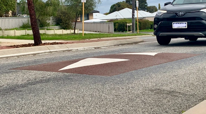
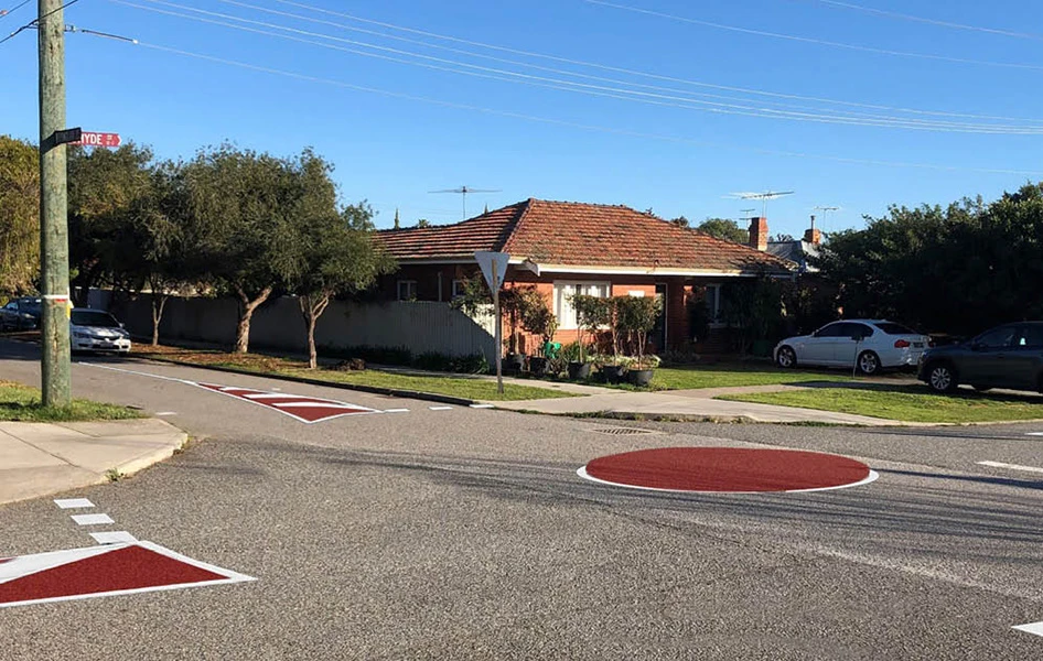
Feedback highlighted community support for reducing vehicle speeds in the area with several respondents requesting the treatments be extended. The proposed treatments, including speed cushions and raised safety platforms, are designed for this purpose and will help support the reduction and severity of crashes.

With the support of Main Roads WA, the City will be proceeding with the proposal. Construction of the treatments will be scheduled in the current financial year.

View plan: Plan of treatment locations

Phase: Consultation closed (1 August – 22 August 2025)

View report: View the consultation report.

FAQs

Anyone can nominate a ‘black spot’ for funding. Nominations for locations are invited from state and territory governments, local councils, community groups and associations, road user groups, industry and individuals. Find out more at the Department of Infrastructure, Transport, Regional Development, Communications and the Arts. 

Funding is mainly available for the treatment of Black Spot sites, or road lengths, with a proven history of crashes.

The program recognises that there are road locations that could be considered as accidents ‘waiting to happen.’ Some program funds may be used to treat sites where a Road Safety Audit, undertaken by road traffic engineers, identifies that remedial work is necessary, allowing for proactive safety works to be implemented before an accident happens. 

As part of the consultation process, it is important that the City gain community support prior to applying for project funding.

The City will consider all the submissions during the community consultation and report on findings within the submission process.

Traffic and road safety programs

Kerbing, verges and crossovers

For more information, or to receive this information in an alternate format, please contact the City on (08) 9205 8555 or visit www.stirling.wa.gov.au/enquiry.

Share this page